Derivation of sea-ice surface topographic height from TanDEM-X Interferometric SAR data
PhD student: Lanqing Huang
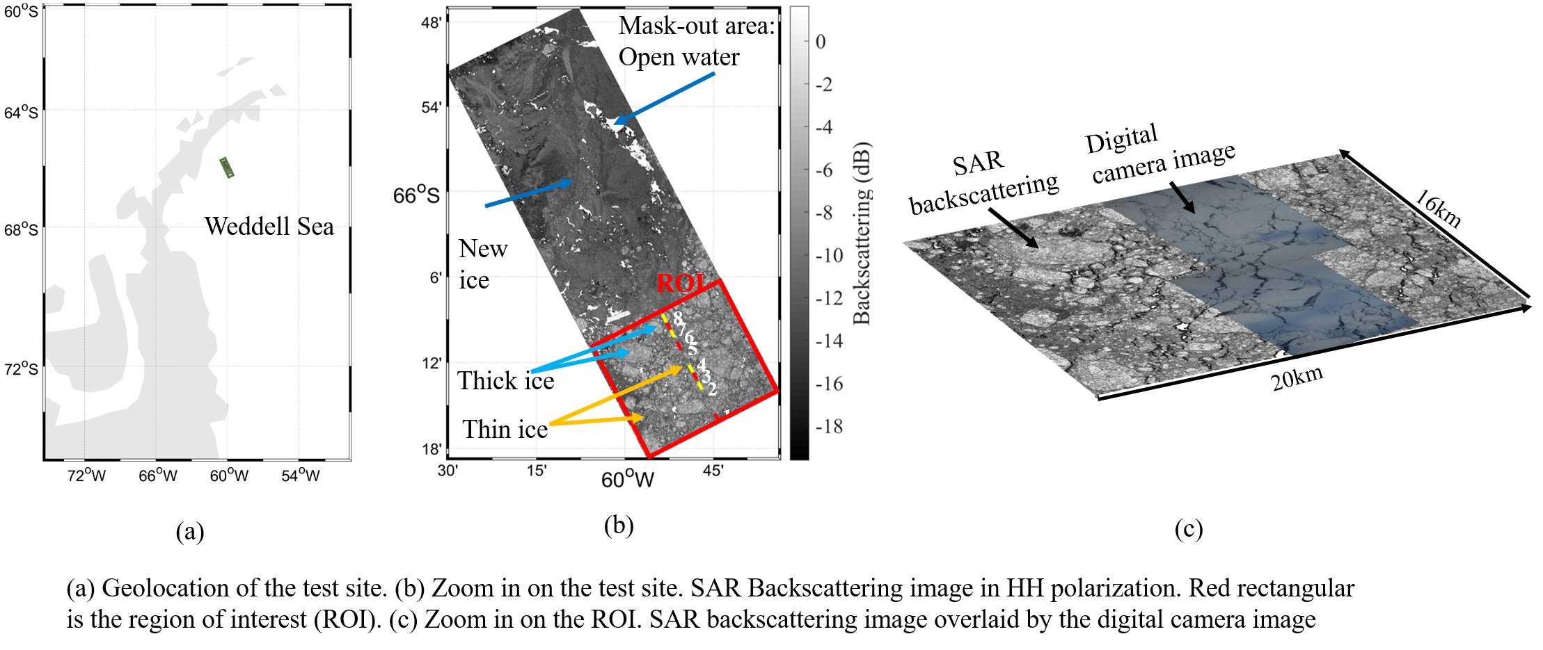
Antarctica owns the most massive ice sheet in the world. The topography of ice is dominated by ice ridges, shear zones, rubble fields, and hummocks, leading to an intermittent change of the ice topography. The main objective of this study is to generate accurate digital elevation models by SAR data over sea ice close to Antarctica.
TanDEM-X is a synchronized SAR satellite formation of two satellites and can be regarded as a single-pass SAR interferometer. With its single-pass nature combined with the flexibility for both spatial and temporal baseline, the retrieval of sea-ice surface topography in a relatively short-time window becomes possible.
In this research, the polarimetric behaviour for the derivation of sea ice digital elevation model is investigated. We studied several factors which contaminate the sea-ice height retrieval. The aim is to propose a new model for topographic estimation using interferometric, polarimetric, and polarimetric-interferometry SAR techniques. The investigations are validated against stereo camera data profiles from an airborne campaign conducted at the same time as TanDEM-X acquisition.