Development of a car-borne SAR system
PhD student: Roberto Coscione
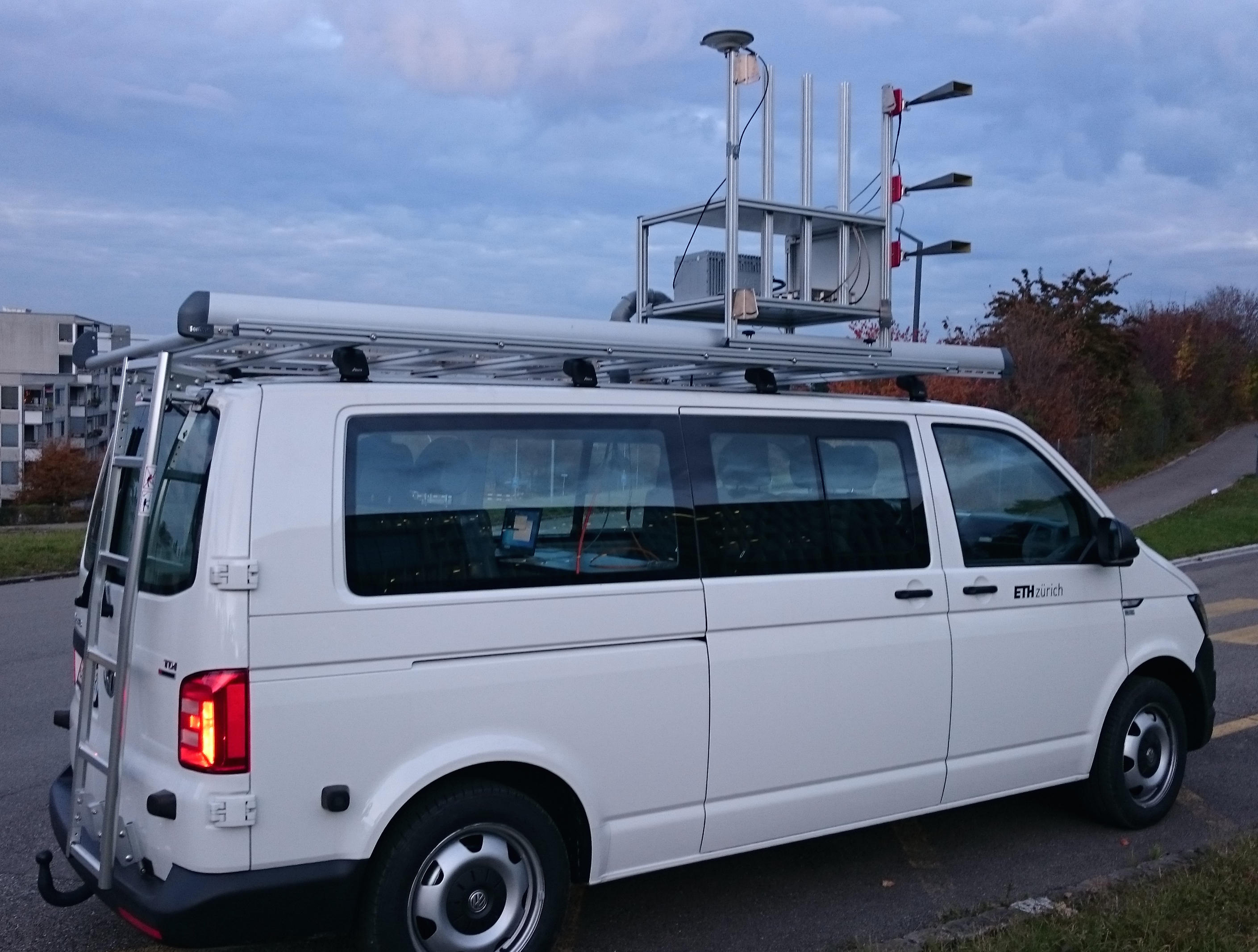
Within this external pageCTI/KTI project a car-borne differential interferometric synthetic aperture radar (SAR) system is developed in collaboration with Gamma Remote Sensing AG. This novel terrestrial SAR system is designed to measure surface displacements with high resolution based on time series of interferometric SAR images, e.g., to assess geohazards.
In contrast to the existing terrestrial radar systems currently available, this new car-based SAR system measures the feature of interest while the radar sensor is passing by.
In this way, aperture synthesis can be performed along a much longer integration path, on the order of 50-100m, compared to moving the sensor on a short rail as employed in "quasi-stationary" SAR systems, or compared to feasible antenna dimensions in the case of real-aperture radar systems, of typically a few meters.
While the stationary systems are bound to relatively high frequencies (typically around 17.2 GHz) to ensure an acceptable resolution in the dimension perpendicular to the antenna pointing direction, the proposed car-based system can operate at a lower frequency (at L-band, around 1.3 GHz) and still achieve a high resolution. The car-borne SAR system is thus complementary to the stationary terrestrial systems in terms of its more favorable temporal de-correlation properties obtained at L-band. This means that deformation time series can be obtained over a longer time span also when observing natural terrain.
The project involves 1) the design and implementation of the hardware of a frequency-modulated continuous-wave (FMCW) radar at L-band frequency, performed by the industry partner, 2) the integration of the radar with a high-precision INS/GNSS for accurate relative positioning and attitude information, and 3) the development and testing of the interferometric processing algorithms required to map displacements from such an agile platform. These two aspects of the project are investigated and implemented at IfU.