Snow and glaciers
Snow and glaciers play an important role in the climate system as they have a strong influence on the radiation balance. Additionally both act as an important source of fresh water. Radar remote sensing allows large coverage observation of regions that are difficult to access and can provide data about mass balance of glaciers, very accurate ice velocities, information about snow fall and the water stored in the snow pack. Even avalanche activity and the risk of serac-falls can be monitored using radar instruments during all weather conditions at day and night.
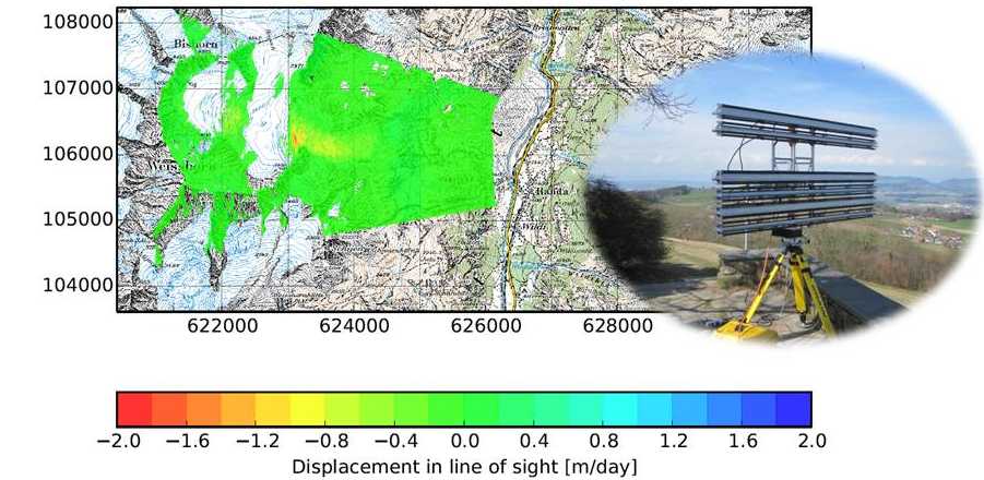
We use space-borne, air-borne and ground-based radar sensors to observe processes in the cryosphere. The ground based radar system called KAPRI, operating in Ku-band (17.2 GHz), is a fully polarimetric and interferometric radar system and allows for measurements with a high temporal resolution which is not achievable with satellite data. This resolution is necessary to monitor fast processes such as avalanches and variations in snow properties through the course of a day.
In summer 2015, the Radar was installed at the Domhütte, in the canton of Wallis, to observe the Bisgletscher, a fast moving Glacier that represents a geohazard.
Images of the glacier were acquired every 2 minutes between July and September. The measurement data was used for near real time monitoring of the potentially dangerous glacier; the large dataset also represents a very good opportunity to develop and test novel processing techniques for time series of interferometric and polarimetric data.
In contrast to ground-based systems, satellite acquisitions provide large scale coverage to monitor changes in the cryosphere. The frequency range of radar instruments between 1 and 10 GHz provides access to the phase of reflected microwave pulses which is currently not possible with optical measurements. Based on phase measurements, we use several techniques to monitor different properties of snow and ice covered terrain.
Radar interferometry is a technique based on the comparison of phase differences obtained by different satellites to compute digital elevation models (DEM) of high accuracy and spatial resolution. By differencing DEMs, measured at different dates, we try to estimate glacier mass balance as well as snow accumulation from satellite data.
Differential interferometry (DInSAR), which compares the phase difference of two radar images obtained at different times, makes it possible to detect signal delays resulting not only from snow cover but also from glacier movements. We develop methods to detect changes of the snow water equivalent stored in the seasonal snow pack.
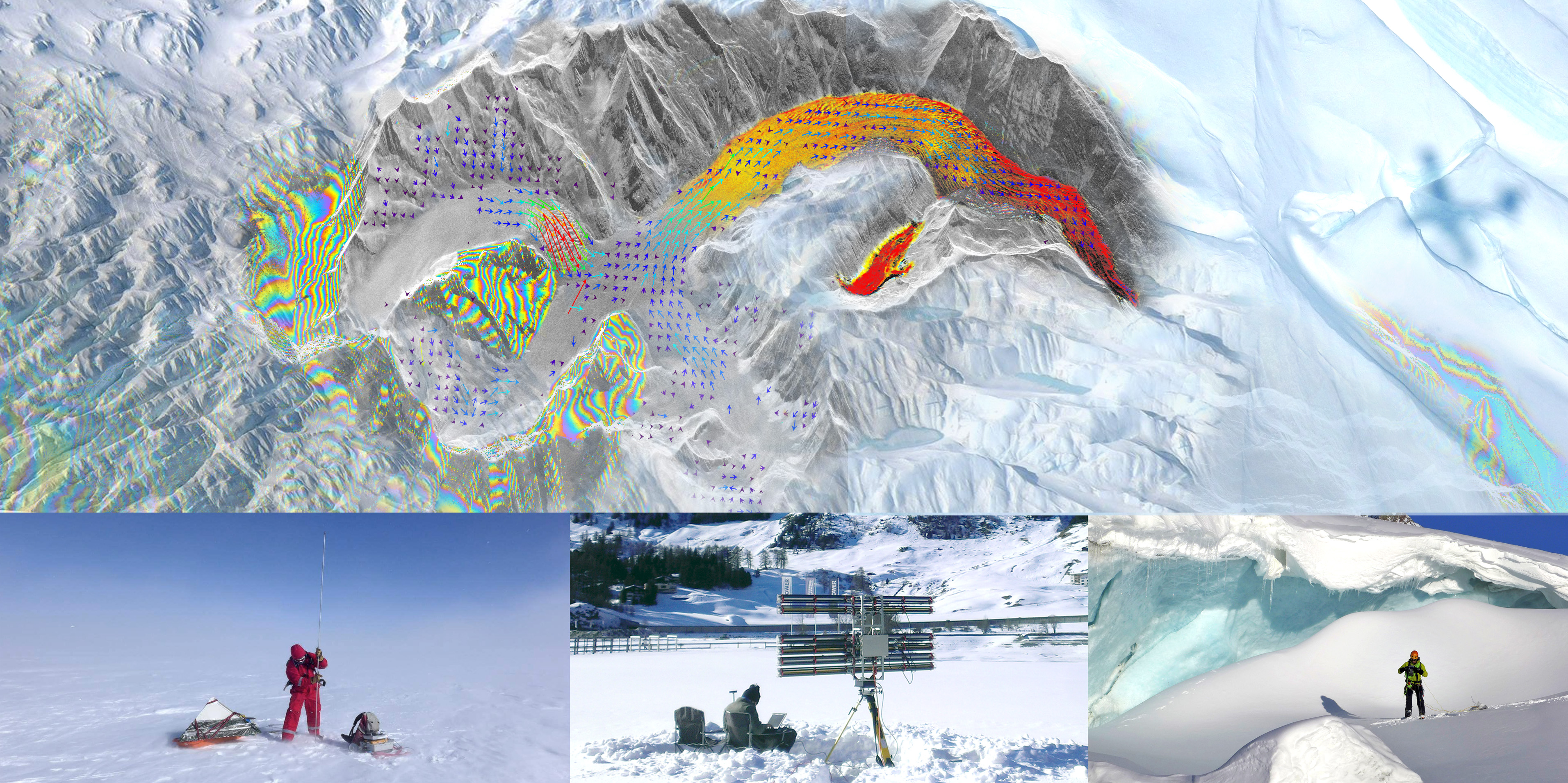
The high resolution of radar images together with a high temporal repeat time provides an excellent data source for feature tracking algorithms to determine the velocity and even velocity changes of glaciers. We use different satellite sensors to monitor glacier velocity in order to understand the reasons for their velocity variations.
We work on methods to gain insight into snow metamorphism processes and to estimate the amount of fresh snow based on the analysis of polarimetric radar signals. The anisotropy of snow can be determined from orthogonally polarised microwaves which are transmitted through the snow pack. Backscatter experiments on snow samples are also planned to gain insight into the difficult scattering processes of microwaves in snow.