SAR interferometry
The interferometric phase among a pair of complex SAR images may contain several phase components, such as those related to topography, surface deformation, atmosphere refractivity changes, soil moisture, etc. besides measurement noise and decorrelation. Often, specific to an application, one phase component is relevant while the others tend to act as disturbances. Sophisticated processing techniques, as well as an appropriate selection of sensors, are employed to extract the relevant components while mitigating the disturbances.
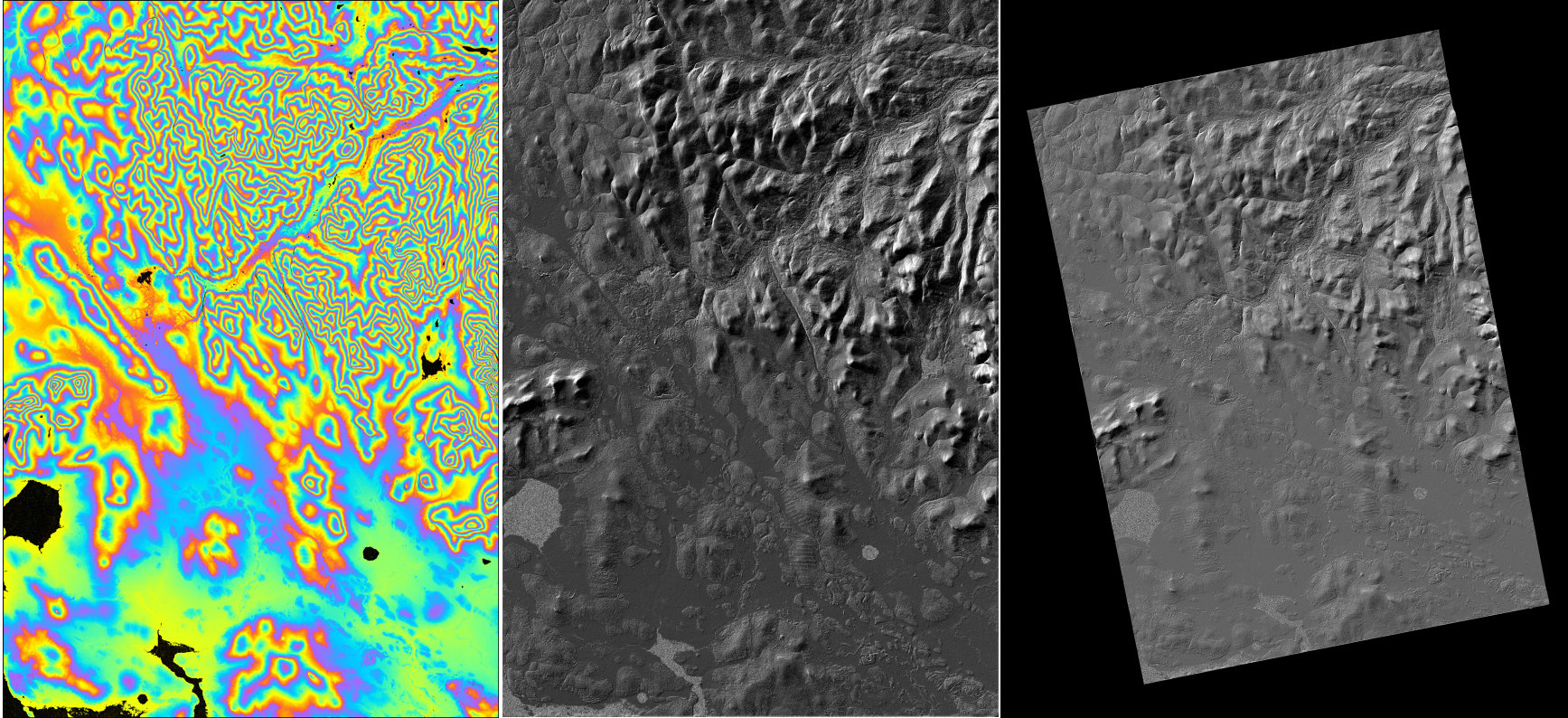
As an example, the topography-correlated phases can be extracted to synthesize high resolution digital elevation models (DEMs), such as the following DEM generated from a pair of TanDEM-X acquisitions:
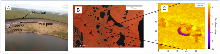
By differencing DEMs generated at different instants in time, we can perform change detection. The following image shows an application of this technique to monitor changes in the permafrost in the Mackenzie River Delta, Canada:
In differential SAR intereferometric (DInSAR) approaches, the topographic phase component is removed to extract a deformation map, while carefully mitigating the sources of decorrelation and other disturbances. The centimetre accuracies that can be achieved have made this technique useful for characterizing many processes and movements, such as those related to volcanic activities, the movement of glaciers, or subsidence caused by permafrost-thaw. This measurement works by combining two radar acquisitions from different times. During this time gap, the moisture content of the soil can change and such changes can impact the DInSAR signals and thus the deformation estimates. Analysis of satellite and airborne measurements, as well as dedicated experiments using the group's ground-based radar systems can help characterize the properties and magnitudes of these effects. The end goals are:
- to model the effect of soil moisture changes in mineral and organic soils on DInSAR measurements
- to elucidate the impact of vegetation dynamics on these measurements
- to estimate soil moisture changes and vegetation parameters from radar data
- to improve deformation estimates by correcting for these effects and quantifying the associated uncertainties